Share
Since 2008, there has been a demonstrated push by Federal, Provincial/Territorial, and Municipal governments to create open access to data. One by one, each of the provinces - excluding Prince Edward Island - have created open data portals to a certain extent, with municipalities and cities creating their own open data initiatives.
As of 2015, the Open Government Partnership (OGP) Open Data Working Group, a partnership between the Government of Canada and the Web Foundation, the Government of Mexico, the Open Data for Development (OD4D) Network, and the Omidyar Network have come together to create an International Open Data Charter. Globally, there are 520 listed open data portals, spanning all continents inclusive of Antarctica, thanks to the Australian-Antarctic Data Centre. Other key players, such as the Government of the United Kingdom and the United States of America, are also involved in the creation and development of these initiatives. In fact, the Open Data Barometer gives the United Kingdom a perfect 100 in the rankings of data openness, with the United States following closely with a 92.66. Canada, with a much smaller scale and significantly less amount of time as an independent nation, ranks 7th overall with an 74.52 and continues to improve annually.
Province of Ontario
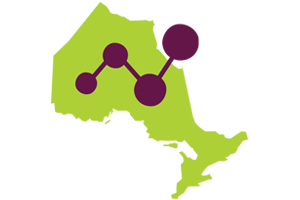
With 1,293 data sets available across 22 different categories, the Province of Ontario allows you to analyze everything from rentable square footage in Ontario Courthouses to the number of grants give to organizations under the Adult Non-Credit French as a Second Language Program, data related to completed appeals under the Line Fences Act to the top baby names since 1917. With 11 file types available and a variety of levels of availability, this concentrated effort by the Province of Ontario gives citizens, organizations, and corporations key pieces of information necessary to their growth and reach.
City of Ottawa

The Capital of Canada does not disappoint when it comes to open data. Outside of a well designed database for open data on a city level, Ottawa does a few extra things that really make it an exceptional place. There is an annual open data application contest, aptly called Apps4Ottawa, with eight categories to win Gold, Silver, and Bronze, along with an overall winner. There are also a few citizen-based groups, such as Open Data Ottawa, that put together events to transform public data into solutions that better their city.
Waterloo Region
Here in Waterloo Region, we have a variety of data sets available. The City of Kitchener and the City of Waterloo both have their own segregated open data portals with city-specific information. The City of Waterloo even has a forum where citizens can give their ideas and suggestions concerning open data, including the type of data that they want available and solutions to transform data into more easier to understand methods. While the City of Cambridge does not have its own portal, the three cities and the rest of the townships in the region have their data sets housed in the Region’s open data portal.
The Municipality of Chatham-Kent

Finally, a big shout out to my hometown of Chatham, Ontario for having an Open Data Portal. The entire municipality spans a large plot of land in Southwestern Ontario due to the fact that 90% of the area is soybeans and cattle, which means even the smallest of villages (I’m looking at you, Pardoville, population one family and an apple orchard) have plotted various elements.
This is the standard I’m going to set for the rest of the country: if my hometown, with more cows than there are people, can create an open data portal and GIS hub, you can too!